Category:RAF Wittering
Jump to navigation
Jump to search
| Object location | | View all coordinates using: OpenStreetMap |
|---|
Royal Air Force support station in Cambridgeshire, England  | |||||
| Upload media | |||||
| Instance of |
| ||||
|---|---|---|---|---|---|
| Location | Peterborough, City of Peterborough, Cambridgeshire, East of England, England | ||||
| Owned by | |||||
| Operator | |||||
| Inception |
| ||||
| ICAO airport code |
| ||||
| official website | |||||
 | |||||
Subcategories
This category has the following 3 subcategories, out of 3 total.
W
- RAF Wittering in World War II (11 F)
Media in category "RAF Wittering"
The following 16 files are in this category, out of 16 total.
-
 100 years of the RAF MOD 45163614.jpg 5,604 × 5,569; 15.85 MB
-

-

-
-

-
 A47(T), Wittering airfield perimeter fence - geograph.org.uk - 84203.jpg 640 × 480; 126 KB
-
 Air Traffic Control Tower - geograph.org.uk - 466410.jpg 640 × 480; 110 KB
-
 AVM Warren James and SAC Megan Hubbard (cropped).jpg 453 × 444; 76 KB
-
 AVM Warren James and SAC Megan Hubbard.jpg 1,360 × 1,020; 200 KB
-
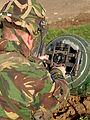
 Dragon Runner Bomb Disposal Robot MOD 45151223.jpg 2,396 × 2,400; 973 KB
-
 Driveway to Easton Lodge - geograph.org.uk - 414003.jpg 640 × 427; 108 KB
-
 Harrier GR3 (20579671948).jpg 1,400 × 933; 326 KB
-
 RAF Wittering - geograph.org.uk - 466398.jpg 640 × 480; 93 KB
-
 Towards Vigo Wood - geograph.org.uk - 466394.jpg 640 × 480; 76 KB
-
 Water Tower RAF Wittering.jpg 640 × 480; 92 KB
-
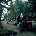
 Wing Parade - RAF Wittering.jpg 1,407 × 1,078; 1.37 MB


_MOD_45147740.jpg)
,_Wittering_airfield_perimeter_fence_-_geograph.org.uk_-_84203.jpg)
.jpg)


.jpg)


